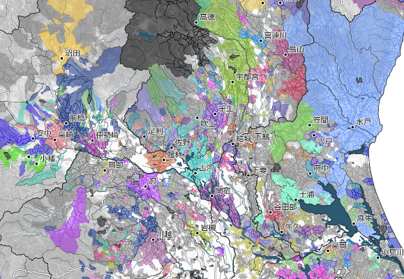
幕末の藩領分
江戸時代最末期、慶応4年1月1日時点の藩領分 / The territories of the domains during the final year of the Edo period.
Open Map
江戸時代最末期、慶応4年1月1日時点の藩領分 / The territories of the domains during the final year of the Edo period.
Open Map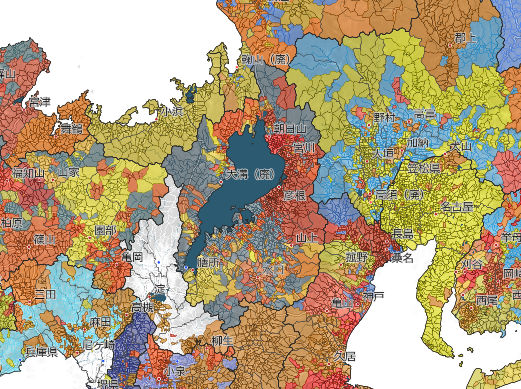
1871年の廃藩置県直前の府藩県三治制時代の領分 / Territories under the three-tier system of provincial, domain, and prefectural administration immediately prior to the abolition of the domains and establishment of prefectures in 1871.
Open Map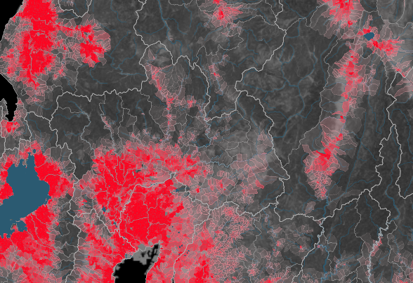
幕末の全国の石高密度を可視化した地図 / A map visualizing the density of kokudaka (Rice yield) across Japan during the late Edo period
Open Map